Verdant countryside brimming with ancient forests and sheep-grazed hills is a staple in the Emerald Isle. Its landscapes are also full of drama and variety, from ragged peninsulas in the Atlantic to thunderous mountains. If you’re looking for some inspiration for an outdoor adventure, Ireland’s natural wonders are among the best in Europe, some with global recognition for their unusual appearance. Here are 10 of the top things to do in rural Ireland, including some of the best hiking destinations in Ireland.
Kerry UNESCO Biosphere Reserve
Racing through the mossy oak and yew woodland of the Kerry UNESCO Biosphere Reserve is the last surviving native herd of red deer on the mainland, revived in recent years after nearly becoming extinct. In the west, narrow ridges and sharp peaks rise through the treetops in this 65,000-hectare (160,619-acre) wilderness, with trails leading to Ireland’s highest mountain viewpoints in MacGillycuddy’s Reeks.
Killarney National Park, located within the reserve, is a place where history and nature converge, featuring a castle, abbey, and 19th-century mansion to explore. Waterfalls run off the mountaintops into rivers that connect a trio of glacier-carved lakes decorated with tiny islands and stone bridges. It’s said that a mythical monster named Muckie hides in the depths of these waters.
Experience it on: Ireland: Coastal Hikes, The Beara Peninsula & Killarney National Park
Cliffs of Moher
Like a fortress running 14km (9 mi) along the shores of County Clare, the Cliffs of Moher stand as a 214m (702 ft) wave-thrashed wall against the force of the Atlantic. Millions of years of history are fossilized between the layers of cool gray sandstone and shale, visible on its sheer serrated rock face. They form a unique geological blend, earning this rugged coastline global recognition as part of a UNESCO Geopark. As well as a rich past, it’s a place that’s still full of life. On top of the cliffs, the grassy plains glow with pink, yellow, and purple wildflowers peeking through the green in spring and summer. Year-round, it serves as a protected sanctuary, busy with more than 20 species of seabirds, including puffins, razorbills, and guilemots.
Experience it for yourself on: Highlights of Ireland
Kenmare Bay
Coves and sea caves, accessible only from the water, line the edges of Kenmare Bay, which sits at the head of a 48km (30 mi) inlet, the Kenmare River. Framing the water on either side are the green hills and mountaintops of the Beara and Iveragh peninsulas. Hugging the shores are salt marsh meadows, heaths, and sea cliffs, all protected areas full of wildlife. Tiny isles are sprinkled along the waterway, with waddling Atlantic puffins on Rossdohan Island. Other seasonal guests also visit throughout the year, such as common dolphins, white-tailed eagles, and seals. Playful European otters often linger around freshwater springs, where they wash salt off their fur. They are nocturnal, so watch for them at dusk or dawn.
Experience it on: Ireland: Charming Villages, Traditional Tales & Hiking the Dingle Peninsula
Derrynane Bay
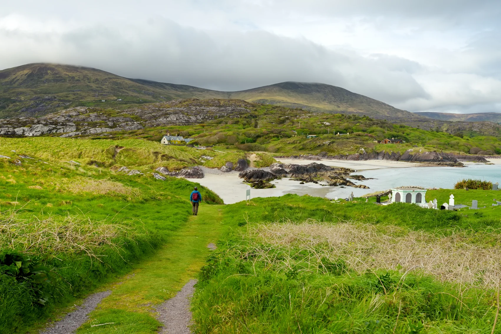
The water of Derrynane Bay always seems to glisten the same shade of soft turquoise, a beauty trait unique to the shallow sea and pale sand of its sheltered lagoon. Tucked away from the wide open Atlantic, it’s an ideal spot for windsurfing, sailing, kayaking, and surfing. Backing the 1.5km (0.9 mi) of sandy shores are rolling, wildflower-sprinkled dunes. At low tide, a passage across to Abbey Island appears, allowing access to the 6th-century cliffside abbey ruins and a new perspective for admiring the bay. Inland, a 1.2km (0.7 mi) seashore trail showcases the area’s past and present, looping through old potato growing ridges, a bird sanctuary, and freshwater marshes bursting with reeds traditionally used for thatching roofs. Taking you all the way back to the 4th century, not far from the waterfront, is Ogham Stone, etched with the earliest form of writing in Ireland.

Experience it for yourself on: Ireland Family Journey: Castles, Folklore & Gaelic Traditions
Inisheer Island
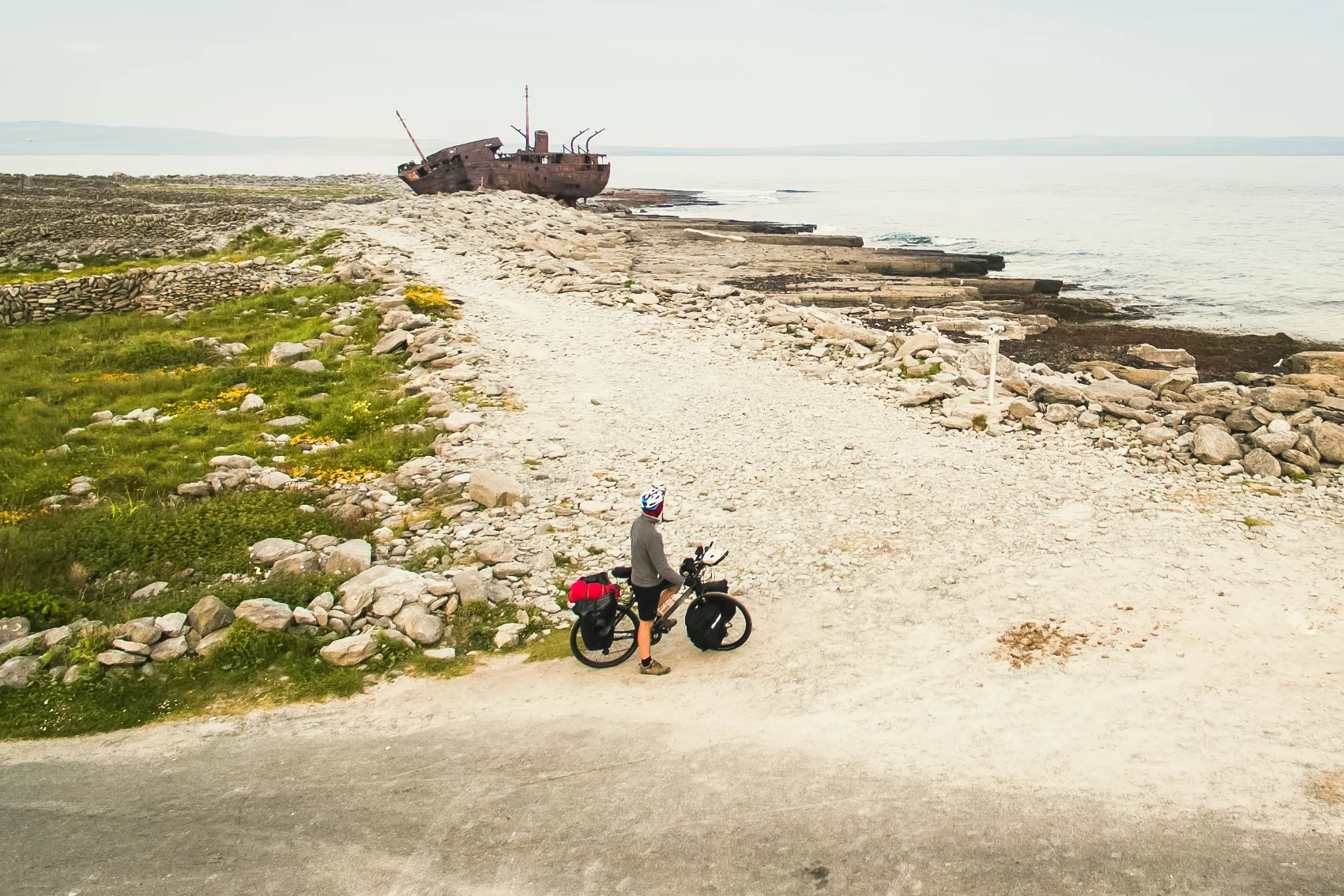
A pocket of cultural charm and rugged, windswept beauty, Inisheer, also known as Inis Oírr, is part of the trio of Aran Islands, set in the mouth of Galway Bay. On foot, a full loop of the island can be polished off in about two hours, along the ocean-front pavement of deep grooved slabs of limestone formed by glaciers 350 million years ago. Along the way, you pass the rusting skeleton of the Plassey shipwreck, which is desperately trying not to topple over, just like the locals who drained the ship of a cargo load of whiskey immediately after it was beached in the 1960s.
Away from the waves, the 15th-century ruins of O’Brien’s Castle sit at the highest point of the island, a modest 60m (200 ft) above sea level. Believe it or not, it’s a hugely worthwhile vantage point for the views. From this booster seat of a hill, you can gain some perspective on the extent of the 2,415km (1,500 mi) of centuries-old, hand-stacked dry stone walls crisscrossing through the grassy landscape.

Experience it on: Ireland: Charming Villages, Traditional Tales & Hiking the Dingle Peninsula
Howth Head
Have you heard of Dublin’s seabird haven, with 100m (328 ft) coastal cliffs and hidden shingle coves? Just a 30-minute train from the capital city, and you’re at Howth Head. Past the regal 15th-century castle’s rhododendron gardens at the fishing-boat-filled harbour, the 8km (5 mi) Howth Cliffs Loop trail begins. Heather and salt-sprayed shrubs line the footpath above the Irish Sea, where you can sometimes spot dolphins. Sunbathing seals laze on the beaches below, and more than 140 species of birds nest here and dive for fish. It’s an area of national importance for breeding black-legged kittiwake, and in May to July, puffins are usually around the nearby rocky islet, Ireland’s Eye.
Experience it for yourself on: Journeys: Iconic Ireland
Dingle Peninsula
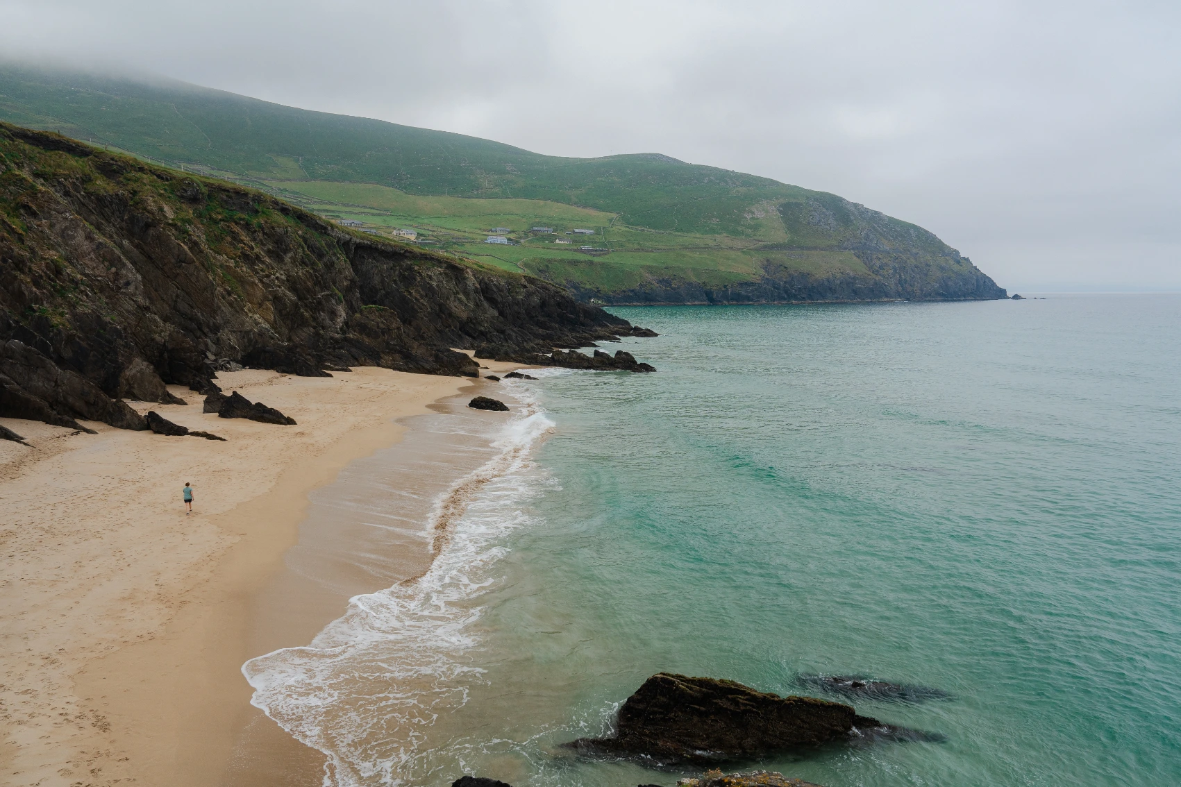
Spilling some 48km (30 mi) into the North Atlantic Ocean is the enchanting Dingle Peninsula. Its centrepiece is the Brandon Mountains, cut with narrow, twisting roads climbing to heights of 460m (1,496 ft). Craggy ridges taper down to still glacier lakes and grassy farmland, where standing stones and domed beehive huts offer a glimpse into Ireland’s human history. Sharp headlands and wide natural harbours shape the Dingle Peninsula’s coastline. In the south, there’s nothing but soft, blond sand and grassy dunes on the 5km-long (3 mi) Inch Split. In the summer months, if you look out toward the Blasket Islands from Coumeenoole Beach, at the pinnacle of the peninsula, you might see dolphins and whales passing by.

Experience it on: Ireland: Charming Villages, Traditional Tales & Hiking the Dingle Peninsula
Blasket Islands
Just off the Dingle Peninsula, six larger islands and a handful of skerries make up the Blasket Islands, the westernmost points of Ireland. Approaching from the east, you can see the “sleeping giant” or “dead man” of Inishtooskert Island, which, from a distance, is how it appears from its silhouette. The main residents on this archipelago of sea cliffs, sandy vanilla beaches, and golden gorse-wrapped hills are puffins and an 800-strong seal colony. But that’s been the case only since 1953, when the last of a small community of dwellers abandoned Great Blasket. Their deserted, stone-built, roofless village remains.
Experience it on: Ireland: Coastal Hikes, The Beara Peninsula & Killarney National Park
Giant’s Causeway
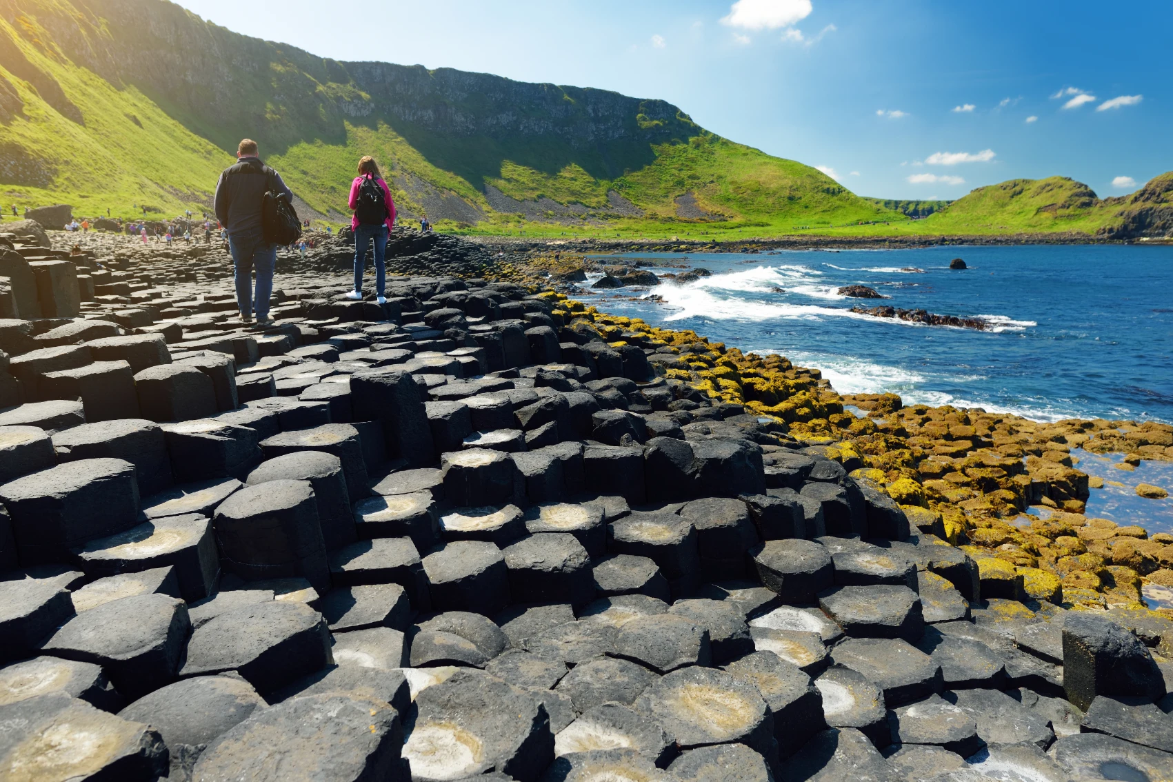
Perfectly geometric hexagonal basalt columns ripple out of the ground from the hillside into the clear Irish Sea in Northern Ireland. Legend has it that this unusual UNESCO World Heritage Site was built by Finn McCool, an Irish giant determined to cross the sea to fight his Scottish rival, Benandonner. Finn ran away once he saw how huge he was, and Benandonner tore up the causeway after he also backed out of retaliating. For the naysayers, scientists say the Giant’s Causeway was formed 60 million years ago when lava cooled and cracked under pressure into polygonal shapes. There are more than 40,000 of these rusty-black coloured blocks, perfectly interlocking like 3km (1.8 mi) of warped honeycomb, rising to heights of 25m (82 ft).

Experience it for yourself on: Highlights of Ireland
Gleninchaquin Valley
Little has changed in the 70,000 years since glaciers carved this narrow valley. Hidden in the foothills of the Caha Mountains is a chain of lakes fed by streams and waterfalls, and one wide rock face cascade tumbles from 140m (460 ft). Otters can be seen splashing in the brooks, while red grouse roam the heather moorland found on steeper slopes beneath the summits. Foot trails in Gleninchaquin Park take you over log bridges and into the mossy glens and ancient woodlands. Wandering sheep nibble on the pasture around the two empty 18th-century stone and thatched cottages.
Experience it on: Ireland: Coastal Hikes, The Beara Peninsula & Killarney National Park