
Planes, trains, and automobiles. New Orleans is one of the easiest places to visit in the country because of the abundance of easy transportation. However, how you get to New Orleans entirely depends on how you like to travel.
Flying into the New Orleans airport is easy, with over a dozen direct flight destinations and several major airlines servicing the airport. Riding Amtrak is easy with three routes leading to New Orleans from Chicago, New York, and Los Angeles.
This may be surprising, but driving is my favorite way to travel to New Orleans. Driving is simple, with three major interstate highways connected to New Orleans, one of which is an epic transcontinental route between Florida and California.
Which way do you prefer to travel to New Orleans? Leave me a comment below, along with your best tip for getting to New Orleans.
Map of New Orleans | Airport, Amtrak, and Interstates
How to use this map | Click the icon in the top-left corner to open the Map Legend, then click on any of the legend items to display more information. If you have a Google account, click the (very faint) star at the end of the map’s name to save this map to your account, then access the map from your smartphone during your trip.

Flying to New Orleans
Louis Armstrong New Orleans International Airport (MSY) is a convenient way to fly into New Orleans. The international airport is just 11 miles from downtown, making it closer to the city than many similar airports. In 2001, the airport was named in honor of Louis Armstrong, one of the most influential musicians in the early history of jazz.
Southwest, Delta, American, United, and Spirit serve the airport. In 2023, more than 12 million passengers flew through the airport. Delta, Southwest, and Spirit offer 12 daily direct flights between New Orleans and other cities, like Austin, Texas; Boston, Massachusetts; Burbank, California; Charlotte, North Carolina; and New York City.
Like many other natural features in New Orleans, the international airport sits at the lowest elevation of any airport in the country at 4 feet above sea level.
MSY is a small airport with three concourses spread throughout a single terminal. There is a total of 35 gates servicing a wide variety of aircraft.
The airport offers a notable selection of restaurants representing the best of New Orleans. Café du Monde, Bar Sazerac, and PJ’s Coffee are a great introduction to the city.
MSY has a great selection of rental cars that are perfect if you plan to visit the surrounding wildlife management areas or drive to Venice, the southernmost point in Louisiana, by car. Rideshares are easy to book with Lyft (iOS | Android) and Uber (iOS | Android) operating in New Orleans.

Riding Amtrak to New Orleans
New Orleans is a central hub for Amtrak, with three routes connecting at Union Station. Getting on a train to New Orleans from Chicago, New York, and Los Angeles is easy. With additional connections, getting from almost anywhere in the continental United States to New Orleans by train is possible.
Union Passenger Terminal at the southwest edge of downtown New Orleans near Caesars Superdome, home of the New Orleans Saints NFL team. The staffed station features plenty of indoor seating, restrooms, ticket sales, and vending machines.
The New Orleans Regional Transit Authority (NORTA) UPT-Riverfront Streetcar has a stop at the train station. The streetcar connects to the Canal Streetcar and St. Charles Street routes.
Although the train station is within walking distance – a lengthy walking distance – of downtown hotels, restaurants, and attractions, I recommend booking a rideshare with Lyft (iOS | Android) or Uber (iOS | Android) to get around.
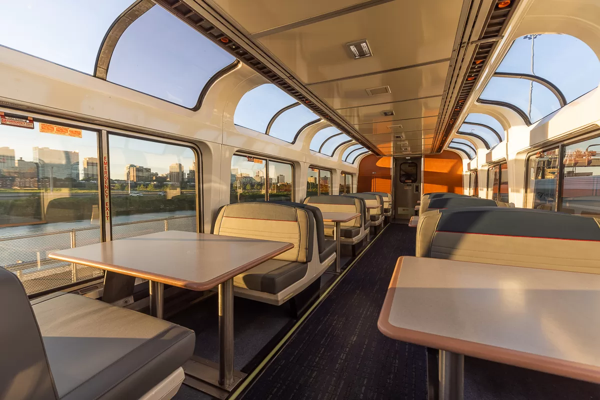
Pro Travel Tip | I recommend budgeting for a roomette or bedroom if you plan to spend more than 15 hours on a train. These rooms include many amenities like private showers, personal rooms, and included meals.
City of New Orleans Route | Chicago, IL to New Orleans, LA
The City of New Orleans Route is 931 miles between Chicago, Illinois, and New Orleans. One train departs each direction every afternoon, taking about 25 hours to travel the entire route.
The trains include Superliner cars with roomettes, bedrooms, and bedroom suites for travel families or groups of friends. Each train includes a dining car with three meals prepared throughout the day.
The City of New Orleans Route has 19 stations between Chicago and New Orleans. Popular stops along the route include Memphis, Tennessee, and Jackson, Mississippi.
Crescent Route | New York, NY to New Orleans, LA
The Crescent Route is 1,300 miles long between New York City and New Orleans. One train departs each direction every day – the train departs New Orleans in the morning and New York City in the afternoon. Additional trains depart Atlanta and Washington, D.C. daily.
It takes about 30-40 hours to ride the entire route, making it one of the longest continuous Amtrak routes in the country. Trains include upgraded Viewliner cars with roomettes, bedrooms, and bedroom suites for traveling families and groups of friends. Each train includes a dining car with café service, serving three meals per day or four meals along the entire route.
The Crescent Route has 35 stations between New York City and New Orleans. Popular stops along the route include Philadelphia, Pennsylvania; Baltimore, Maryland; Washington, D.C.; Greensville, South Carolina; and Atlanta, Georgia.
Sunset Limited Route | Los Angeles, CA to New Orleans, LA
The Sunset Limited Route is almost 2,000 miles between Los Angeles, California, and New Orleans. Three trains depart weekly in each direction, taking about 48-55 hours to travel the entire length.
The trains include Superliner cars with roomettes, bedrooms, and bedroom suites for traveling families and groups of friends. Each train also includes a dining car with café service, which prepares three meals daily.
Did You Know | From Los Angeles to San Antonio, Texas, the Sunset Limited and Texas Eagle routes share the same railroad. This gives you more opportunities to book a passage with a connection in Texas.
The Sunset Limited Route has only 22 stations, limiting the options to explore other places while keeping the travel time to just two nights aboard the train. Popular stops include Tucson, Arizona; San Antonio and Houston, Texas; and Lafayette, Louisiana.
Driving to New Orleans
Three interstate highways connect to New Orleans, making it an easy destination to drive to. During my visit to New Orleans, I drove Interstate 85 from Charlotte to Atlanta, Interstate 20 to Meridian, and Interstate 59 to New Orleans.
Pro Travel Tip | When driving long distances on interstates, I recommend downloading iExit (iOS | Android). The app uses your GPS location and direction of travel, and then lists the gas stations, fast food chains, and restaurants at upcoming exits.
Interstate 10 | Jacksonville, FL to Los Angeles, CA
I-10 is the southernmost transcontinental interstate highway in the country. The 2,460-mile highway stretches across the country from Jacksonville, Florida to Santa Monica, California. It’s the fourth-longest interstate in the country after I-90, I-80, and I-40.
Major intersections of I-10 include:
- Interstate 75 in Lake City, FL
- Interstate 65 in Mobile, AL
- Interstate 59 in Slidell, LA
- Interstate 55 in Laplace, LA
- Interstate 49 in Lafayette, LA
- Interstate 45 in Houston, TX
- Interstate 20 in Scroggins Draw, TX
- Interstate 25 in Las Cruces, NM
- Interstate 17 in Phoenix, AZ
- Interstate 15 in Ontario, CA
- Interstate 5 in Los Angeles, CA
In Slidell, Louisiana, a large town northeast of New Orleans, Interstates 10 and 59 combine. The interstates cross a narrow end of Lake Pontchartrain. After the intersection with I-510, Interstates 10 and 59 pass through the residential outskirts of New Orleans.
Interstates 10 and 59 pass along the northwestern edge of downtown New Orleans, curving away from the city near the Caesars Superdome. Several exits provide quick entrance into downtown – Exit 235 leads to Canal Street, the main thoroughfare into downtown.
Interstate 55 | Chicago, IL to New Orleans, LA
I-55 is a major interstate highway bisecting the country through the Midwest. The 965-mile highway connects Chicago, Illinois, and New Orleans. It’s the primary route for traveling from the Great Lakes to the Gulf Coast.
Major intersections of I-55 include:
- Interstates 94 and 90 in Chicago, IL
- Interstate 80 in Channahon, IL
- Interstate 74 in Bloomington, IL
- Interstate 72 in Springfield, IL
- Interstates 70 and 64 in St. Louis, MO
- Interstate 57 in Sikeston, MO
- Interstate 40 in Memphis, TN
- Interstate 69 in Hernando, MS
- Interstate 20 in Jackson, MS
- Interstate 12 in Hammond, LA
Interestingly, I-57 parallels I-55 from Chicago, Illinois to Sikeston, Missouri. The alternate route follows the same route as the City of New Orleans Amtrak route. I-55 passes through larger destinations like St. Louis and Springfield, while I-57 passes through Shawnee National Forest and central Illinois.
After crossing I-12 in Hammond, Louisiana, I-55 passes between Lake Pontchartrain and Lake Maurepas. In Laplace, a small town west of New Orleans, I-55 merges with I-10. From there, the two interstates travel along the edge of Lake Pontchartrain.
After the intersection with I-310, Interstates 10 and 55 pass Louis Armstrong New Orleans International Airport and travel into the residential suburbs of New Orleans.
Interstate 59 | Meridian, MS to New Orleans, LA
I-55 is a short connector interstate highway. The 445-mile highway connects Trenton, Georgia, and Slidell, Louisiana, cutting across Alabama. It’s the primary route for anyone traveling to New Orleans from Chattanooga, Atlanta, and Birmingham.
Major intersections of I-59 include:
- Interstates 20, 65, and 22 in Birmingham, AL
- Interstate 20 in Meridian, MS
- Interstate 10 in Slidell, LA
In Slidell, Louisiana, a large town northeast of New Orleans, Interstates 10 and 59 combine. The interstates cross a narrow end of Lake Pontchartrain. After the intersection with I-510, Interstates 10 and 59 pass through the residential outskirts of New Orleans.
Interstates 10 and 59 pass along the northwestern edge of downtown New Orleans, curving away from the city near the Caesars Superdome. Several exits provide quick entrance into downtown – Exit 235 leads to Canal Street, the main thoroughfare into downtown.