While there are a couple of short and fun scenic drives in the park, I would argue that the best way to experience Saguaro National Park is hiking. There are many miles of trails to explore: these are the best hikes in Saguaro National Park.
Located in southern Arizona, this was the very first national park created specifically to protect a plant species—the iconic saguaro cactus. A true symbol of the American West, saguaros are the largest cactus species in the country.
They’re native only to the Sonoran desert and can get up to 50 feet tall. They’re literally as tall as trees and so abundant in this area that there are actual saguaro forests. (Since they’re filled with water, saguaros are much, much heavier than trees.)
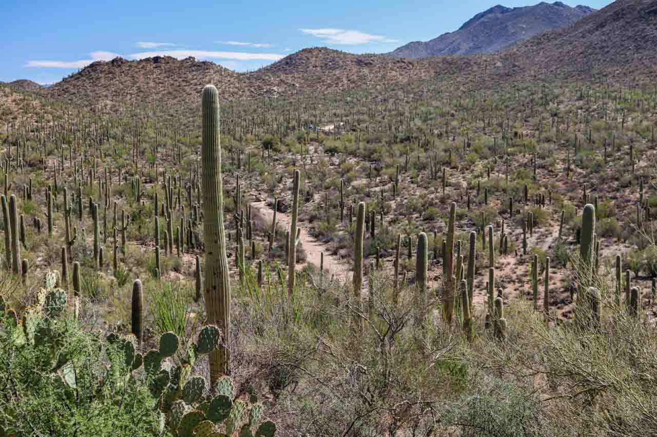
When hiking in Saguaro National Park, you get to see these “sentinels of the desert” from up close.
You’ll walk among them, underneath them and past them, on the way admiring multi-armed saguaros, baby saguaros hiding in the shade of a nurse tree, and other regional desert flora.
This post about the best hikes in Saguaro National Park contains affiliate links, which may earn us a commission. You can read more about our Terms of Use / Disclosure here.
Explore Saguaro National Park on These 7 Trails
Split up into two separate districts, one on each side of Tucson, Arizona, Saguaro National Park is super-accessible. To fully experience the park in its all variety, however, you’ll need to visit both districts.
I’d recommend two days in the western district, also known as the Tucson Mountain District, and one day in the eastern district, called the Rincon Mountain District.
Best Hikes in Saguaro National Park West (TMD)
Signal Hill Trail

Barely worthy of the description “hike”—it’s only 0.15 miles one way—the Signal Hill Trail still deserves to be included in any overview of the best trails in Saguaro National Park for one main reason.
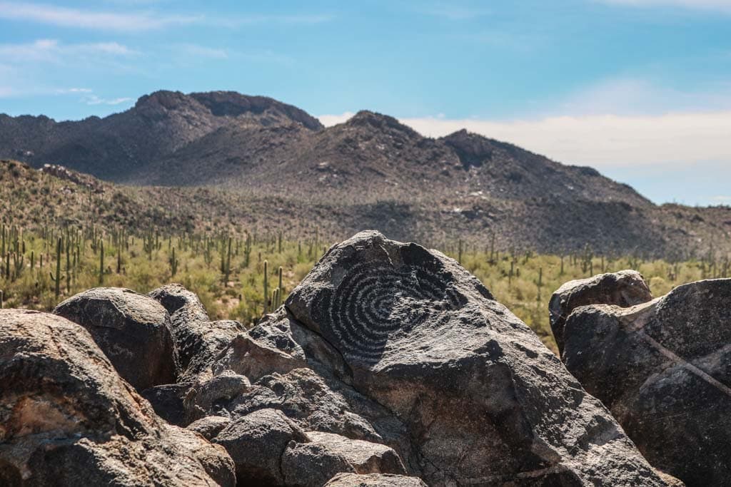
This short climb leads to a site that encompasses dozens of 800-plus-year-old Native American petroglyphs, one of the highlights in the park.
The trail starts at the Signal Hill Picnic Area and involves a series of stone steps up the hill. There was a sign warning for rattlesnakes when we where there, so watch where you put your feet.
At the top, there’s a fantastic view of the petroglyphs, as well as the desert landscape all around.
- Distance: 0.3 miles, out and back
- Duration: 20 minutes
- Difficulty: Easy
- Trailhead: Signal Hill Picnic Area
Valley View – Wild Dog Trail

Combining two wonderful trails in the middle of the scenic Bajada Loop Drive, the Valley View – Wild Dog Trail is a great hike to immerse yourself in the stunning Saguaro desert scenery.
From the Valley View Parking Area, which was built by the Civilian Conservation Corps, leads to a viewpoint where you can see the Avra Valley below and Picacho Peak to the north.
The Valley View Trail is only 0.8 miles roundtrip, so if you’d like to do a longer hike in this area, you can extend it by hiking the Wild Dog Trail. This trail runs from one side of the Bajada Loop Drive to the other.
If your group has both hikers and non-hikers, this is great opportunity to drop the hikers off at one end and pick them up at the other.
- Distance: 2.5 miles, out and back
- Duration: 1 hour
- Difficulty: Easy
- Trailhead: Valley View Parking Area (or Signal Hill, which adds about 0.5 mile)
King Canyon – Gould Mine Loop

If you’re looking for moderate hikes in Saguaro National Park, I can’t think of a better one than the King Canyon – Gould Mine Loop.
This 1.5-hour desert journey takes you between the King Canyon walls and up the sandy wash bottom via the King Canyon Wash Trail. When you arrive at the trail junction, you can opt between the return trip via the King Canyon Trail or the Gould Mine Trail.
This loop hike offers beautiful desert scenery, including the wash itself and the countless saguaro cacti that surround it.
Note: Because of the humid environment created by the wash, the King Canyon Trail is one of several locations in Saguaro National Park where Africanized honey bees are present (also known as “killer bees”). When you notice bees, especially swarms of them, indicating a nest, avoid them to prevent attacks.
- Distance: 2.4 miles, loop
- Duration: 1.5 hours
- Difficulty: Moderate
- Trailhead: King Canyon Parking Area
King Canyon Trail to Wasson Peak

My personal favorite hike in Saguaro National Park is the 7-mile round-trip to Wasson Peak via the King Canyon Trail.
With its height of 4,687 feet, Wasson Peak is the highest mountain in the Tucson Mountains. The views from the top are spectacular—I’d even go as far as to stay they’re the best in the entire park.
The parking area and trailhead are directly across the road from the Arizona-Sonora Desert Museum, which is also worth visiting if you have some spare time.
The King Canyon section of this hike overlaps with the King Canyon – Gould Mine Loop above. You could take the Gould Mine Trail back on the way down to combine both Saguaro National Park hikes.
I particularly love this hike because it offers a well-rounded desert experience. On the way, you can see and often even hike in desert washes and canyons, and on old mining roads.
As you climb higher, the views start opening up, up to the point where you’re literally above the entire landscape. It’s arguably the best day hike in Saguaro National Park.
- Distance: 7 miles
- Duration: 3.5 hours
- Difficulty: Strenuous
- Trailhead: King Canyon Parking Area
Best Hikes in Saguaro National Past East (RMD)
Mica View – Cactus Forest Loop

A great introduction to the beautiful scenery of the Rincon Mountains, the Mica View – Cactus Forest Loop is a short loop hike through a saguaro cactus forest.
The trail starts at the Mica View Picnic Area, which is at the end of a spur road off the scenic Cactus Forest Drive, a popular driving and cycling loop.
The Mica View Trail (North) has a hard surface, is wheelchair-accessible and makes for a wonderful out-and-back hike.
The Cactus Forest Trail, however, is not suitable for wheelchairs. Whichever option you choose, this excellent Saguaro National Park hike offers views of Tanque Verde Peak and Mica Mountain.
Additionally, it’s also a great area to see young saguaros under nurse trees, while birds like cactus wrens, curve-billed thrashers and Gila woodpeckers are common sights.
- Distance: 2 miles
- Duration: 1 hour
- Difficulty: Easy
- Trailhead: Mica View Picnic Area
Loma Verde Loop

Experience the diversity of the southern Arizona desert on the Loma Verde Loop. Starting at the Loma Verde Parking Area, the trail runs north through a grove of large mesquite trees.
You’ll pass a seasonal wash and ascend a small bluff towards a bajada, Spanish for a gravel plain on the base of mountain.
After about 1.5 miles, turn right onto the Pink Hill Trail, where a spur trail leads to a beautiful viewpoint. Follow the Pink Hill Trail to the Squeeze Pen Trail, which will take you back towards to Loma Verde Trail and the trailhead.
This is a fantastic—and easy—2-hour hike in Saguaro National Park’s Rincon Mountain District.
- Distance: 3.8 miles
- Duration: 2 hours
- Difficulty: Easy
- Trailhead: Loma Verde Parking Area
Tanque Verde Ridge Trail

Awesome views and seasonal wildflowers make this a worthwhile, although possibly difficult, hike in Saguaro National Park’s west district. The trail starts at the Javelina Picnic Area, the southern point of the Cactus Forest Drive.
The ridge is about 0.75 miles from the trailhead, a pretty strenuous ascent. From there onward, the Tanque Verde Ridge Trail follows the ridge and offers panoramic views to the north, west and south.
You can hike this strenuous Saguaro National Park trail as far as you want. The views are amazing once you’re on the ridge, only about half an hour in, but do get even better as you continue to climb the ridge.
The Juniper Basin Campground sits at the 6.9-mile mark, while Tanque Verde Peak is 8.7 miles from the trailhead. The roundtrip to Tanque Verde Peak is the most strenuous of all day hikes in Saguaro National Park, but you could also make this an overnight backpacking trip.
- Distance: As far as you want (8.7 miles one way to Tanque Verde Peak)
- Duration: 30 minutes to overnight backpacking trip
- Difficulty: Moderate to strenuous
- Trailhead: Javelina Picnic Area
Have You Explored Some of These Saguaro Trails? Which Are Your Favorite Hikes in Saguaro National Park? Share Your National Parks Experience in the Comments Below!
